Groundwater dependent ecosystems
Groundwater dependent ecosystems (GDEs) are defined as ‘ecosystems that need access to groundwater to meet all or some of their water requirements to maintain their communities of plants and animals, ecological processes and ecosystem services’. GDEs include a broad range of environments and can be highly specialised, possessing unique characteristics that ‘separate’ them from other ecosystems. The dependence of GDEs on groundwater varies from seasonal or episodic, to continual. They can range in size from a few metres to many square kilometres.
Types of groundwater dependent ecosystems
Aquifer ecosystems
Diverse subsurface community of fauna that inhabit the pore spaces and voids of groundwater environments, termed ‘stygofauna'. Stygofauna include a broad range of organisms which include ‘macro’ invertebrates and vertebrates that can be seen with the naked eye, ‘micro’ organisms termed ‘meiofauna’ (invertebrates that can only be seen with a microscope) and bacteria (biofilm) communities. They have many values, including the following: some are rare or unique; the ecosystems surviving in aquifers and caves are amongst the oldest surviving on earth; and they have water quality benefits, biodiversity value and add to the ecological diversity in a region.
Cave and karst ecosystems
These are cavities in rock that act as a conduit for water flow between input points, such as stream sinks, and output points, such as springs or seeps. A karst is a specialised form of cave that are formed by the greater solubility of certain rocks in water. Most karsts form commonly in limestone and other carbonates such as dolomite. However, they can also form in evaporites such as gypsum and halite, silicates such as sandstone and quartzites, and in some basalts and granites. Caves in general can form in many types of rock through processes other than solution. All can support aquatic and terrestrial ecosystems.
Base flow stream ecosystems
Are streams supported by groundwater discharge or spring fed? It is these that sustain flows in many streams during dry times. Understanding the interactions between groundwater and surface water is fundamental to understanding and managing the chemical and biological characteristics of streams throughout their lengths. River base flow ecosystems include a combination of subsurface and surface ecosystems depending on the structure of the river bed sediments. Groundwater base flow in sand-bed and gravel-bed rivers support both riparian vegetation and in-stream macrophyte communities, surface water aquatic invertebrate communities, and a specialised community of invertebrates (termed hyporheos) that exist below the river bed / substrate surface in the hyporheic zone.
Groundwater dependent terrestrial vegetation (Phreatophytes)
Phreatophytes do not rely on the surface expression of water for survival but depend on the subsurface presence of groundwater, often accessed via the capillary fringe (i.e. the subsurface water just above the water table that is not completely saturated). Phreatophytes include both deep and/or shallow rooted vegetation communities. Forests and woodlands can rely on groundwater for survival, particularly in areas of shallow groundwater. The degree of groundwater dependence can vary, the literature indicating seasonal variability in both the quantity of groundwater used and the relative importance of groundwater as a water source.
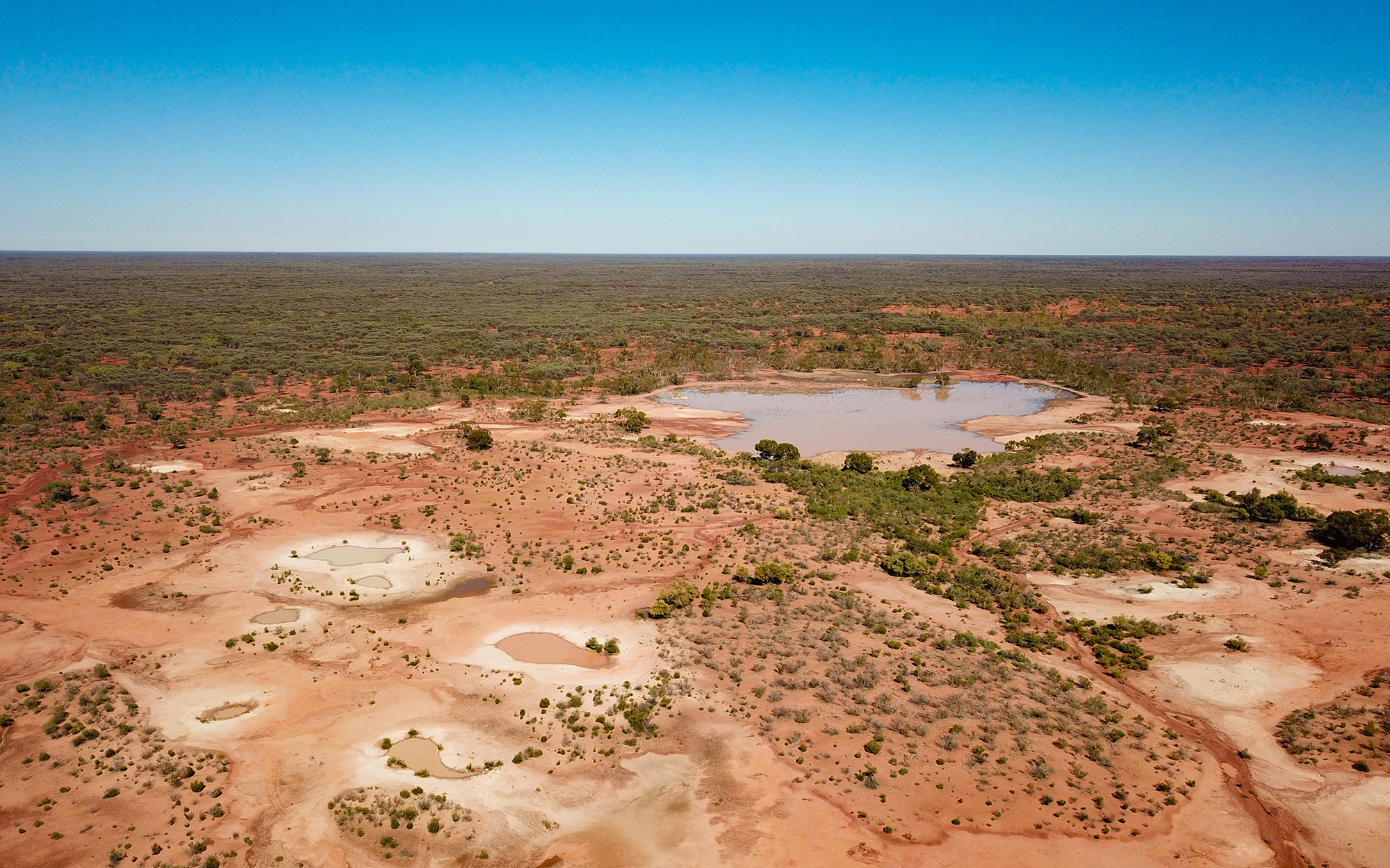
Groundwater dependent wetlands
Wetland ecosystems can depend on groundwater to keep them seasonally waterlogged or flooded e.g. paperbark swamp forests and woodlands, swamp sclerophyll forests and woodlands, swamp scrubs and heaths, swamp shrublands, sedgelands and mound springs ecosystems. Groundwater dependent wetlands exist at the boundary between surface and groundwater systems. They facilitate the flow of water between the groundwater system and the surface-water system. Groundwater dependent wetlands can be found in the mountains, on the plateaus and high plains, in river valleys and in coastal lowlands.
Great Artesian Basin springs
The Great Artesian Basin springs project seeks to ground-truth springs in the NSW extent of the Basin and collect hydrogeological and ecological data. The results will increase our knowledge of the Great Artesian Basin and its springs and therefore help improve management of the Basin.
The Great Artesian Basin is one of the largest underground freshwater resources in the world.
Groundwater discharges naturally from the Great Artesian Basin into springs, lakes, rivers and wetlands. Most discharge areas, such as springs, are found along the basin’s perimeter where water is closer to the surface. Great Artesian Basin springs can support endangered ecological communities and species, known as groundwater dependent ecosystems. GAB springs are listed under the Commonwealth Environment Protection and Biodiversity Conservation Act 1999. GAB springs are also listed for protection under the Water Sharing Plan for the NSW Great Artesian Basin Groundwater Sources 2020.The Great Artesian Basin springs project surveys springs fed by groundwater sources, located within the NSW extent of the Basin.
The Great Artesian Basin springs project was initiated to inform the remake of the Great Artesian Basin water sharing plan and to support the documentation of recovering artesian pressure on springs, an offshoot of the Great Artesian Basin Sustainability Initiative (1999-2017) and the Cap and Pipe the Bores programs. The project also aligns with the guiding principles of the Commonwealth Great Artesian Basin Strategic Management Plan 2018. The project was undertaken at the same time as the first round of bore inventory. The inventory informs the program of work of the Great Artesian Basin Sustainability Initiative and documents the outcome of the initiative.
We highly value landholders contribution, knowledge shared with us and the relationships formed during the field work stage of the project.
Hydrogeological and ecological data collected during the project are summarised in the Hydrogeology and ecology survey report (PDF, 5673.49 KB). The report defines the surveys and provides a summary of the results, then documents each of the springs visited. The survey outcomes are two fold.
- It validates historical knowledge on the presence or absence of springs and provides information on the condition of the springs at the time of the survey.
- It also provides a baseline dataset so we can monitor changes over time and undertake additional studies to refine the understanding of the springs and support the management of the springs.
Increased knowledge and understanding of the Basin and its springs helps us to better manage the Great Artesian Basin. The data collected was used to build an understanding on the mechanism of each of the springs by defining the source of groundwater supporting the spring where possible. The work (PDF, 9276.87 KB) uses several lines of approach. Some of the result have a high level of confidence, other results come with more uncertainty. This work will be used to scope the next round of GAB spring field work and define more adapted management measures for the protection of the GAB springs.
Estuarine and marine ecosystems
Many estuarine and near-shore marine systems depend on groundwater discharges to provide suitable habitats for a diverse group of flora and fauna e.g. coastal lakes, mangroves, saltmarshes and seagrass beds. They can be separated from coastal wetlands by the reliance on seawater and tidal influences and groundwater discharge may be in the form of direct off-shore discharge zones called ‘Wonky Holes’, diffuse discharge through sandbeds or baseflow into streams that discharge to the ocean.
Conceptual GDE model – the following diagram shows where the various types of GDEs are located in the landscape for inland and the coast.

Download a larger diagram of the Groundwater Dependent Ecosystem model (JPG, 2549.47 KB)
Learn more about groundwater dependent ecosystems
Extent of groundwater dependent ecosystems
The degree and nature of groundwater dependence will influence how GDEs are affected by changes in the quality and quantity of groundwater systems. The dependence on groundwater can be variable over time, often increasing during droughts, or reducing when wetter conditions prevail. Furthermore, species and communities that require permanently wet conditions, particularly in arid and semi-arid areas, are more likely to be groundwater dependent than those tolerant of a regular cycle of wetting and drying. This dependency on groundwater is why ecological processes in GDEs may be threatened by the regular extraction of groundwater and changes in land use or management.
To improve the way GDEs are managed, it is important to understand where they are located, as well as their level of groundwater dependence. To increase this understanding, a mapping project has been completed that identifies vegetation communities that have a high probability of being groundwater dependent.
Water sharing plans include maps of high priority GDEs. The plans contain distance rules that restrict where groundwater works may be located to minimise the risk of groundwater extraction impacting GDEs. To apply these rules, we need to confirm the high probability of groundwater dependence for the mapped GDEs.
High probability GDE spatial data is available for download via the Bureau of Meteorology Groundwater Dependent Ecosystems Atlas and the NSW SEED Portal, and can be viewed via the department's spatial portal.
Assessing the ecological value of groundwater dependent ecosystems
As the protection of GDEs in water sharing plans needs to be balanced with the demands of licenced water users, protection is restricted to high priority GDEs. By assigning an ecological value to GDEs, management needs can then be prioritised. The approach used to value individual GDEs adopted by NSW is the high ecological value aquatic ecosystem (HEVAE) framework.
The department's Water Group developed the GDE Ecological Value (HEVAE) spatial database using recorded and predicted spatial data to provide weighted scores for each attribute associated with four HEVAE criteria (distinctiveness, diversity, naturalness and vital habitat). The “representativeness” criteria was not applied to the dataset due to insufficient data being available. The Overall GDE Ecological Value (HEVAE) diagram (JPG, 213.93 KB) summarises the data used for each of the HEVAE criteria. The combined scores categorise the ecological value of each groundwater dependent vegetation community from very high to very low. Very high and high value GDE’s are considered high priority in water sharing plans.
The GDE HEVAE dataset is available for download via the NSW SEED Portal.
Groundwater dependent ecosystem threats
Water quantity
Changes in water quantity, either by the decrease in groundwater levels through extraction to meet the needs of agriculture or industry, or increases in groundwater levels through land clearing are threats to GDEs. Either lowering or increasing groundwater levels has the potential to cause a change in GDE community structure.
Water quality
Urban, commercial and tourist developments as well as intensive agricultural land use can adversely affect groundwater quality and, therefore, the ecosystems that depend on that groundwater. Changes in water quality caused by the following can occur: nutrients from fertilisers and septic tank effluent, salt intrusion, agricultural pesticides, metals and hydrocarbons from commercial and urban land uses (e.g. leakage from underground fuel tanks, can contaminate groundwater). Exposure to such contaminants can pose a direct short and long term threat to the ecology of GDEs.