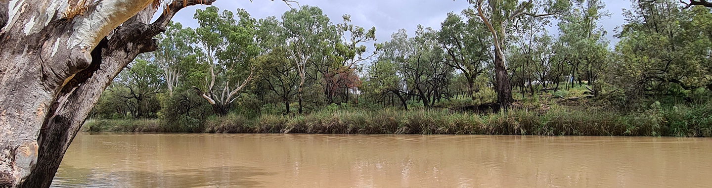
Surface water environments include rivers, creeks, streams, lakes, floodplains, wetlands and reservoirs. Surface water is also found in estuaries and tidal pools at the mouth of major rivers on the coast.
Surface water supports the plants and animals that live in these environments. Surface water can also replenish groundwater. This can support groundwater dependent ecosystems such as vegetation and wetlands.
All surface water environments are important for environmental, cultural, social and economic purposes. Sustaining our surface water environments and the ecosystems that they support is a primary aim of the Water Management Act 2000 (NSW).
Why do we do water science in NSW?
We use science to learn about the needs of freshwater plans and animals so we can manage water in a way that balances the needs of people and the environment. Learn more.
About
Rivers and creeks
NSW has a diverse range of rivers and creeks. Some flow year-round (perennial), others flow during certain times of the year (intermittent) and others only flow during rainfall events, or for a short time after rainfall events (ephemeral). In NSW, our rivers and creeks are classified into those that flow inland and towards South Australia (the Murray-Darling Basin catchments) and those that flow east, or towards the coast (coastal catchments).
Our rivers and creeks are a source of water for:
- environmental needs,
- cultural uses,
- drinking and domestic uses, and
- industrial and agricultural uses.
The ecology of rivers and creeks includes the plants and animals that live in them and rely on them. It includes how these plants and animals interact with their physical environment. The physical environment includes things like:
- the flow regime of a river or creek (hydrology)
- the condition or quality of the water (water quality), and
- the physical riverbed (geomorphology).
The size, frequency, duration, timing and rate of change, are all important parts of the flow regime. These are the main categories of flow regime:
- Cease-to-flow - the partial or total drying of the river channel. It causes the channel to disconnect into pools.
- Base flows or low flows - the flows that occur most of the time, confined to the low flow part of the channel.
- Freshes - the small and large flows after rainfall. The flows inundate riverbanks and in-channel bars and benches. They are often pulsed events travelling downstream.
- Bank full flows - large flows often occurring at intervals greater than a year. The flows help define the channel and are below the threshold for overbank flows.
- Overbank flows - infrequent flows where water moves out of the main river channel and onto the floodplain.
Across Australia our knowledge of how rivers and creeks function is incomplete. We use science to improve our understanding of how river environments in NSW respond to changing flow regimes. Changes might be due to droughts, floods or water use. We also look at potential impacts from catchment land use and climate change. This information is essential for water planning and policy development. It also ensures that the way we manage our water resources aims to prevent any decline in river health.
Lakes, floodplains and wetlands
Lakes
A lake is a large body of water surrounded by land. Lakes vary in size, depth, altitude and whether they are considered open or closed. Most lakes in NSW are considered open as water flows in and out through a river or other outlet.
The east coast of NSW has a variety of lakes formed by flowing rivers and creeks that combine with saltwater environments to become estuaries.
Inland NSW has many lakes. The Menindee Lakes system in south-west NSW is regulated for water management purposes. Some reservoirs or dams are considered lakes, but these are not natural lake environments.
Lakes can be critical nursery grounds for aquatic organisms. They often support a large range of plants and animals.
Floodplains and wetlands
A floodplain is an area of land which connects to rivers and creeks during heavy rainfall events and overbank flows. Floodplain soils are usually made up of sediments deposited from past flooding events over many centuries. Some areas of floodplains remain wet after flood waters recede. These wet areas are wetlands.
Floodplains and wetlands are unique ecosystems. They support diverse ecological communities including threatened species. Many native trees and aquatic plants are reliant on the water that makes its way onto floodplains and into wetlands. Floodplains and wetlands provide ideal conditions for aquatic insects to thrive. They are also food for other animals such as fish, frogs and waterbirds. Healthy wetlands mitigate floods by acting like a sponge, storing excess water and releasing it slowly over time. They recharge groundwater and reduce soil erosion. The cycle of wetting and drying stimulates growth and the breeding of plants and animals.
Wetlands serve as drought refuges for wildlife. During the drying phase plants decompose, release nutrients and establish seedlings. Wetting after flooding triggers rapid growth. Plants, insects, fish, waterbirds and other animals including internationally significant migratory waterbirds, prosper. Without flooding, plant seed banks and insect egg banks can die. Permanent inundation can be degrading for wetlands, changing the health and type of plants growing and the animals living in the habitat.
Floodplain management
Floodplain management decisions need to consider the requirements of the environment. This should be in balance with the cultural, social and economic needs of the community. This ensures the sustainable management of floodplains.
We use science to ensure that the best information is available for floodplain management decisions. This can improve management of water resources for the environment. This includes responding to climate change, and the effects of water management decisions on wetlands of International, National and State significance. For example, the Macquarie Marshes, Gwydir and Gingham wetlands, Murrumbidgee wetlands, the Great Cumbung Swamp and the Booligal Wetlands.
The department coordinates rural floodplain management plans and water sharing plans which define the requirements for the management of floodwaters within floodplain areas.
Estuaries and tidal pools
Estuaries are semi-enclosed waterbodies with variable freshwater input. This provides a significant gradient from freshwater to saltwater. They can be sometimes open (intermittent) or always open to the ocean.
In NSW, the types of estuaries vary from large drowned river valleys, embayments and coastal lakes; to intermittently open coastal lakes and lagoons. Tidal pools occur at the upper limit of some estuaries and are influenced by the changing tides. Incoming tides push saltwater further upstream and as the tide drops, freshwater becomes the dominant influence. This can influence the plants and animals in the estuary.
Estuaries are unique ecosystems that can adapt to changing freshwater input. They provide critical habitats and nursery sites for many species such as fish, birds, marine mammals and invertebrates. They are also highly productive ecosystems, rapidly breaking down and recycling organic matter. Besides their environmental significance, they are very important for cultural, social and economic purposes.
Impacts to surface water environments
The natural flow regimes of rivers vary from year to year and season to season. The plants and animals of our surface water environments are uniquely adapted to this variability. This includes the extremes of droughts and floods.
But our river environments have been significantly altered by human activity, including:
- the construction of dams and weirs
- water extraction for irrigation, industry and town water supplies.
As a result, the flow regime, physical environment, water quality and ecology of many NSW rivers has changed.
Changing rainfall patterns and rising temperatures under climate change is also a significant concern for our river environments. Below we describe some of the key impacts to surface water environments. We use science to help us understand these impacts and inform water management to improve outcomes for the environment.
Regulation of rivers by dams and weirs
River systems with storages such as dams and weirs that are operated to control flows, are ‘regulated' rivers. The storages capture inflows and control the delivery of water downstream for users. Regulating river flow can change the pattern of river flows for many hundreds of kilometres. It can affect the volume, timing, duration, frequency and quality of flows.
For example, natural seasonal flows are often reversed in regulated river systems in NSW (Figure 1). Under natural conditions, high flows and floods occur in late winter and spring, and low flows and drying occur in late summer. But dams and weirs capture and store the high flows and floods of late winter and spring to be released for irrigation purposes in summer. This water is often much colder than the natural flows that would occur during the summer months and may cause cold water pollution.

Figure 1. Regulation of a river can change how flows are delivered downstream compared to a natural unregulated river. The example shows flows during 2020-2021 from the regulated Tumut River compared to the unregulated Goobragandra River in the Murrumbidgee Valley.
Regulation also reduces seasonal high river flows and overbank flows. These flows play an important role for aquatic ecosystems. They help:
- improve connectivity and inflows to downstream ecosystems
- transport important nutrients and carbon used by fish and macroinvertebrates through the system
- allow tiny invertebrates (microinvertebrates) to hatch, grow and reproduce, providing food for other larger animals
- promote growth for flood-dependent vegetation like Coolabah trees
- trigger waterbird, frog and fish breeding events, and
- prevent algal blooms.
Inland NSW
For inland NSW, the regulated river catchments include the Border Rivers (which separates NSW and Queensland), Namoi, Gwydir, Macquarie, Lachlan, Murrumbidgee, Murray (which separates NSW and Victoria) and the Lower Darling River.
Coastal NSW
On the NSW coast, small regulating dams operate on the Richmond River in the north and the Brogo River in the south. Larger regulating dams in the Hunter Valley provide water for the irrigation, mining and power generation industries.
Hawkesbury-Nepean River
The Hawkesbury-Nepean River system has undergone significant change with the construction of Warragamba Dam. It provides a safe and secure drinking water supply for the Sydney region. However, like many other coastal rivers that supply water for towns and industry, it is not classified as a regulated river.
Water from storages in these systems is usually piped to towns and treatment facilities, rather than released downstream. Yet, they can still have a significant impact on aquatic ecosystems by reducing or changing natural flow patterns. Often, the surface water environments downstream receive very little water from the upstream dam.
Water extraction from surface water environments
Surface water extraction is the diversion or take of water, from a surface water environment. The river may be regulated by a dam or weir, or unregulated and relatively free flowing. The term ‘unregulated river’ applies to rivers with no storages and more natural river flows. It can also apply to rivers with dams that do not release water for downstream use (e.g. town water supply dams). Water extraction is an issue in both regulated and unregulated river systems.
Regulated river systems often re-distribute large quantities of water captured and stored in dams. These storages release water to users downstream. Often only a small volume reaches the end of the river system. Yet directly downstream of a dam can receive large volumes of water, delivered in unnatural patterns. For example, sustained bank-full flows during summer for irrigation. This can impact the physical river habitat, water quality and the ecology of the regulated river.
Unregulated rivers are often affected during summer, when river flows are generally low. The extraction of water during low flow periods can impact pools and flowing water habitats like riffles (fast flowing habitats). For example, reduced flow in riffles, can shrink the area of habitat (wetted area), and reduce water depth and speed. This can lead to lost habitat for flow-dependent species, less algae and food resources, crowding of animals, increased temperature and the creation of barriers for upstream and downstream movement.
There are many impacts from water extraction. But the overall impact on surface water environments is reduced water quality and less water for the plants and animals that make these habitats their homes.
Physical modification of river environments
Rivers are valued ecosystems in landscapes across Australia. They are complex and dynamic systems. They provide vital ecosystem functions and water for human use. Where rivers are intact, they provide many services such as, cycling of nutrients, trapping sediment, slowing and temporary storage of flood water and providing habitat. Where riverine geomorphic condition (the physical riverbed condition) is degraded, many of these functions are impaired or lost. A river may cease to flow at a faster rate, floods may speed up through a river reach at a faster rate. This could cause greater scour and erosion of the riverbed, decreasing water quality and increasing the risk of damage to humans and infrastructure.
Fluvial geomorphology is the scientific study of rivers and their environment. Geomorphologists study rivers to understand the processes that form, change and maintain their shape, features and complexity. This includes studying threats to riverine integrity and consequences of disturbance and degradation. It also includes understanding the processes that assist rivers recover to good condition.
Fluvial geomorphology is an increasingly important part of river and water management. The NSW River Styles project aims to identify risks to river condition and prioritise those rivers that may recover towards good condition. This is important to achieve long term goals of having intact water sources, healthy ecosystems and sustainable water use throughout NSW.