Floodplain harvesting reform
What is the definition of floodplain harvesting?
Floodplain harvesting is defined in the NSW Floodplain Harvesting Policy (PDF, 410.45 KB). Under the policy, floodplain harvesting is the collection, extraction or impoundment of any water flowing across a designated floodplain. This includes both overbank flow and rainfall runoff. Changes to this definition would require the endorsement of the NSW Government.
Why is the floodplain harvesting reform important and what does the NSW Government hope to achieve?
The floodplain harvesting reform aims to protect the environment and water users from the impact of unconstrained growth in the activity. Most of the growth in floodplain harvesting in the northern basin is historic, with more than 80% of the growth in on-farm storage volumes since 1994 occurring prior to 2008.
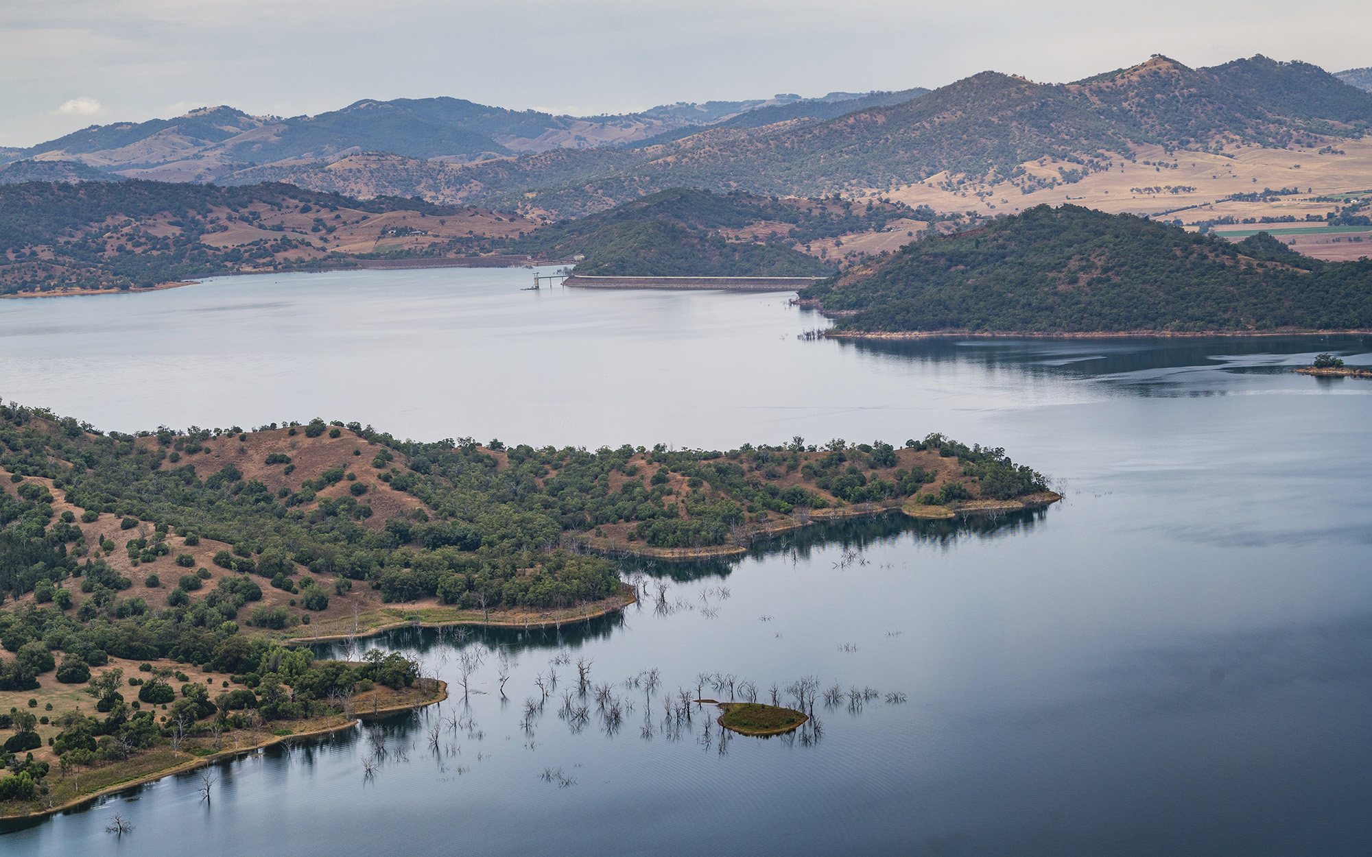
Growth in floodplain harvesting has the potential to adversely affect water users and the environment in the floodplain areas where it occurs. The NSW Floodplain Harvesting Policy (PDF, 410.45 KB) was introduced in 2013 to meet the requirements of the Water Management Act 2000.
It is important that this reform proceeds and the NSW Floodplain Harvesting Policy is fully implemented in order to provide an enforceable legal framework that:
- reduces take where it has caused an exceedance of the legal limits
- prevents further growth.
This will be achieved through the issuing of licences with entitlements and works approvals as well as through the enforcement of measurement and reporting requirements.
Regulation will also:
- improve connection with surrounding areas through more regular inundation
- improve cultural outcomes
- improved environmental outcomes across a range of metrics (waterbirds, native vegetation, native fish and water volumes)
- increase flows to downstream communities
- provide clarity for all water users and the regulator concerning compliance with floodplain harvesting rules
- enable compliance through accurate measurement
- deliver near-real-time information via telemetry
- provide a foundation for adaptive management.
Why do we need to amend the Water Management (General) Regulation 2018?
Key reasons to make legislative amendments are to give legal effect to the policies and to provide legal clarity. The amendments are designed to promote confidence in the process of regulating floodplain harvesting and improve transparency.
Is floodplain harvesting legal?
The legality of floodplain harvesting is uncertain because it was considered lawful under the Water Act 1912 but has not yet been fully transitioned into the current regulatory framework under the Water Management Act 2000.
Section 57A of the Water Management Act 2000, which was inserted into that Act in 2014, enables the making of transitional licensing arrangements for floodplain harvesting. Such arrangements have not been made because the enabling regulations intended to give them effect were disallowed on 6 May 2021. The intent and the effect of these transitional provisions is to convert volumes of water taken as floodplain harvesting into licenced entitlements which limit take to within the legal limits established by NSW water sharing plans, the Water Act 2007 (Commonwealth) and the Basin Plan 2012.
Importantly, the water source legal limits set for each valley reflect the volumes of water taken by floodplain harvesting at a time when it was managed under the Water Act 1912. As it currently stands, the transition process is only partially complete. Specifically, historic floodplain harvesting has already been reflected in legal limits, but there are no licences and approvals in place to manage it, nor is there a licensing exemption.
This incomplete legislative framework is difficult to enforce and has resulted in uncertain obligations and outcomes for all stakeholders. Until there is a clear licensing, measurement and enforcement framework, the current situation will likely persist, although this is contingent on water user behaviour and the actions of the independent regulator NRAR (Natural Resources Access Regulator). For clarity, the current situation means that the management and measurement of floodplain harvesting will not improve, and reduced allocations to supplementary licences will continue to be used to offset growth in floodplain harvesting that has resulted in overall extraction from a water source now being above legal limits.
How will the NSW Government deal with illegal flood works?
Restoring flood flow connections that are impeded by unapproved works is a high priority for NRAR (Natural Resources Access Regulator) .
The NSW Government is currently working to deliver the Improving Floodplain Connections program. NSW Government agencies are collaborating on the program for unapproved flood works in high priority areas in the northern Basin. This program is jointly funded by the Commonwealth Government ($10.196 million) and the NSW Government ($1.08 million).
The program will focus on the acceleration of activities by government and landholders to remove or modify unapproved floodplain structures so that they are compliant with floodplain management plans and approval conditions. The aim is to improve hydraulic connectivity to flood-dependent environmental and cultural assets. The major benefits of the project will be environmental and cultural, in the form of improvements to the health of these areas.
The NSW Government commenced this accelerated compliance program in early 2022 and it is due to conclude in June 2024. Irrespective of Commonwealth funding, bringing unapproved flood works into compliance will continue to be high priority for NRAR and the NSW Government.
Why are there so many on-farm storages in northern valleys?
The hydrology and flows in northern valleys are highly variable and characterised by periods of higher-than-average flows followed by extended periods of lower-than-average flows. In response to this, landholders have built on-farm storages which provide for greater flexibility to extract and store water so that it is available for use during drier periods. On-farm storages are typically used for multiple purposes including storing water taken pursuant to regulated, unregulated, supplementary and groundwater access licences; recycling of used irrigation water, transferring irrigation water around farms, as well as storing floodplain water that is opportunistically harvested during wet periods.
A floodplain harvesting opportunity doesn't occur every year. Therefore, when considering development changes in the northern basin, 1 megalitre of increased storage does not equal 1 megalitre of additional floodplain harvesting. Diversions are a function of water sharing rules, water user behaviour and changes in development.
Is floodplain harvesting constrained to the northern Murray- Darling Basin valleys of NSW?
No. Floodplain harvesting occurs in all designated floodplains across NSW without regulation. There are 6 designated floodplains in the north of the state and 10 in the south. We have prioritised implementation of the NSW Floodplain Harvesting Policy in the northern Murray-Darling Basin because increases in floodplain harvesting in this area have pushed total diversions over the water source legal limits, taking water away from other water users and the environment. A decision to implement the policy in the southern Murray–Darling Basin has not been made and relies on rural floodplain management plans first being in place or well progressed.
For a flood work to be eligible for a floodplain harvesting licence under the NSW Floodplain Harvesting Policy, it must be located within a declared floodplain. Floodplains are declared as part of commencing a floodplain management plan. Work is now underway to develop four valley-wide floodplain management plans in the Murray, Murrumbidgee, Billabong Creek and Lachlan valleys.
What happens long-term if floodplain harvesting is never licensed or exempt?
If floodplain harvesting is never licensed or exempt, then the volume of water historically taken from floodplains could potentially be taken from rivers and creeks instead. This would come at a very significant cost to all water users in the basin as it would significantly diminish river flows. It is in the best interests of all stakeholders that historically legitimate floodplain harvesting be licensed, measured and managed within legal limits.
Is water captured in a tailwater return drain considered a harvestable right?
No. Harvestable rights are limited to rainfall runoff collected in a dam located on a minor stream. Water taken through any other work (including a tailwater drain) requires a licence and approval, unless an exemption is in place. To remove doubt, this includes any water transferred to a harvestable rights dam. The harvestable rights areas and the rules for capturing rainfall runoff in those areas are specified in Harvestable Rights Orders.
What is the licensing framework for floodplain harvesting?
The licensing framework for floodplain harvesting (and other categories of water access licence) consists of the Water Management Act 2000, its regulations, water sharing plans, licences, and approvals, and, for floodplain harvesting, floodplain management plans.
Are floodplain harvesting licences eligible for compensation?
No. A general amendment provision for floodplain harvesting is being included in water sharing plans that allows rules to be amended, omitted or inserted in relation to floodplain harvesting access licences. This amendment provision will allow the water sharing rules for floodplain harvesting to be adjusted by the minister, without triggering compensation. You can read more about compensation entitlements in sections 87(2) and 87AA(3) of the Water Management Act 2000.
Improving Floodplain Connections Program
Program objectives and overview
How will the NSW Government deal with illegal flood works?
Floodplain management plans provide the rules about the flood works that may be constructed on the floodplain. The NSW Government is delivering the Improving Floodplain Connections Program to accelerate the timeframe for bringing unapproved flood works into compliance with floodplain management plans. This program will allow us to achieve by 2024 what would have taken more than 15 years to realise.
What is the aim of the program ?
The aim is to improve hydraulic connectivity to flood-dependent environmental and cultural assets, with the reform’s major benefits being improvements to the health of these areas throughout the five valleys of the northern Murray–Darling Basin. It does this by helping to bring unapproved flood works — identified as a priority — into compliance quickly. Flood works include structures such as levees/embankments, above-ground storages, supply channels, and access roads.
Ensuring that existing unapproved flood works follow the rules will help protect flood-dependent ecosystems, Aboriginal cultural values, and heritage sites, and provide social and economic benefits to downstream water users.
- Find out more about the Improving Floodplain Connections Program and floodplain management plans.
Where are the priority areas?
There have been 96 priority areas identified in the five northern inland valleys – Border Rivers, Gwydir, Namoi, Macquarie, and Barwon–Darling. Within each area there may be one or more unapproved flood work structures. These areas have also been referred to as hotspots.
- View a map of the areas (PDF, 347 KB).
What are priority areas?
A priority area is identified as an area where existing flood structures have potentially adverse impacts on flood flow behaviour and/or may also adversely affect flood connectivity to ecological and cultural assets.
As the program progresses, additional areas of concern may be prioritised for possible inclusion in the program or for referral to the Natural Resources Access Regulator (NRAR).
How have priority sites been identified?
We identified over 500 works across the six floodplains from a range of data and information sources. We used spatial analysis to assess a range of hydraulic, ecological, and cultural features to prioritise flood works. Priority works are those most likely to cause a significant impact on flood water, reaching dependent environmental and cultural assets. The program prioritises structures that will provide the greatest benefit when they comply. For more information, read our Site Selection and prioritisation fact sheet.
What does this have to do with floodplain harvesting?
The program will complement existing floodplain harvesting licensing and measurement regulations by improving floodplain connectivity in areas where unapproved or non-compliant flood works — some up to 30 years old — are impeding natural flows.
Structures on the floodplain are regulated under floodplain management plans, which deal only with structures and how they are best managed to protect life and property, flood flow connectivity, and environmental and cultural assets.
Floodplain harvesting is not within the scope of floodplain management plans and, therefore, this program. The rules for managing floodplain harvesting and associated water access licences sit within the relevant water sharing plan.
- Find out more about floodplain management plans .
Probity – how we ensure fairness, equity, and transparency
What probity measures are in place for the Improving Floodplain Connections Program?
Probity is an important part of the program. We manage consultations and information-sharing with stakeholders (including landholders) in a clear, consistent, ethical, and transparent way, while also protecting privacy and confidentiality.
The Department of Planning and Environment engaged an independent probity advisor to make sure the Improving Floodplain Connections program meets a robust probity framework based on fairness, impartiality, transparency, and accountability.
Is the probity plan publicly available?
Timing and progress
What are the three stages of the program ?
The Improving Floodplain Connections program has three overall stages. Stage 1 relates to preliminary assessment; Stage 2 is about consultation, and Stage 3 is the removal/modification of works to bring them into compliance. Further information on the timeframe for each stage is available at Improving floodplain connections - Water in New South Wales (nsw.gov.au). Consultation will continue throughout the life of the program.
When will the Improving Floodplain Connections program start in the Gwydir, Barwon–Darling River, Namoi, and Macquarie valleys?
We will start engagement with key stakeholders and affected landholders in the Gwydir and Barwon–Darling floodplains in mid to late 2023. We expect to also contact landholders with affected works.
Engagement with key stakeholders and affected landholders in the Namoi and Macquarie River valleys will begin later in the second half of 2023.
Flood work definitions
What types of works are in scope of the Improving Floodplain Connections program?
Works included in the program are structures that meet the Water Management Act 2000 definition of a flood work, are within the priority areas of the Improving Floodplain Connections program and do not have a flood work approval or are being used outside of the approval conditions.
A flood work structure can be:
- an access road
- a building/house pad
- an above- or below-ground channel
- a levee or embankment
- above-ground storage.
Controlled activity approvals are not included in the program.
Is a priority area the same as a flood work?
No. A priority area is an area of interest on the floodplain containing at least some unapproved flood works. It may contain both approved and unapproved flood works and numerous other work types (not just flood works).
Are public roads and structures built by the government included in the program?
Public roads constructed and maintained by council or NSW Government agencies are considered roads authorised under the Roads Act 1993 and are exempt from requiring a flood work approval. However, assessment is undertaken through other approval pathways.
Other structures that are not exempt and proposed by government agencies are required to be assessed and approved by the Department of Planning and Environment’s Licensing and Approvals team.
Will structures need to be modified or removed?
It is a landholder’s responsibility to ensure their flood works are compliant with their approval conditions and the rules. Unapproved structures may be eligible for approval without any modifications to the flood work - in those cases the department will assist landholders in seeking approval through WaterNSW by developing supporting documentation, such as a flood study and/or preliminary environmental assessment for the application.
For flood work structures that do not comply with the rules, and it is not possible for the structure to obtain an approval, landholders will be asked to remove their structure.
If a work needs to be removed, officers from the Natural Resources Access Regulator (NRAR) will work with the landholder to help them on a pathway to compliance. If a landholder refuses to comply, they may be subject to enforcement action.
If a flood work is approved through the Improving Floodplain Connections program, does that mean the landholder can then floodplain harvest?
No. Many flood works are built for other purposes, and approval of a structure or work by WaterNSW does not mean a landowner is automatically approved to floodplain harvest. A landowner must have a floodplain harvesting access licence to take floodplain water, and this access licence must nominate the water supply works used to take water. This is a separate process from the Improving Floodplain Connections program.
Can new sites be added to the Improving Floodplain Connections program?
Unapproved flood works may be added to the Improving Floodplain Connections program if they meet the same criteria used in prioritising sites for the program (which considered the hydrological, ecological, and cultural impacts of the works).
What about unapproved works outside of the priority areas?
Flood works that are not eligible for the Improving Floodplain Connections program to NRAR for further action. The landholder may choose to submit a flood works application to WaterNSW, but they won’t receive support from the Improving Floodplain Connections program on technical assessments, design, or other matters.
Flood work approval applications for private landholders are assessed and approved by WaterNSW .
How is the department responding to unapproved structures identified in the major flooding experienced across the five northern floodplains in New South Wales during 2022?
Flooding in 2022 has provided new data that can assist in identifying high priority flood areas, which is an opportunity for the project to significantly improve the flood risk and ecological outcomes of the project. Using this new data, the department has reviewed non-prioritised unapproved flood works and areas as well as identified new areas. Based on the same systematic approach as the original prioritisation process, the department will add those re-prioritised unapproved flood works or new areas to the program where they are found to have merit.
Modelling and assessment
What flood modelling is the Improving Floodplain Connections program based on?
No specific modelling was undertaken for the Improving Floodplain Connections program prioritisation. Instead, the hydraulic impact assessment identified priority works through analysis of numerous criteria, including but not limited to:
- height of flood structure
- percentage of floodway blocked
- number of floodways blocked
- instream location
- proximity to town levee and extent of impact (measured by flow line and depth of flow in floodway).
Where modelling data was required for the analysis, the Floodplain Management Plan model results were utilised.
Is the assessment data used to identify priority works publicly available?
The data may contain information about flood work approvals and ecological or cultural assets that are sensitive or private, so the data is unlikely to be made public.
However, a summary of the criteria and process used to prioritise sites will be published on the department’s website .
Will there be analysis available that shows changes in the flow distributions on the floodplain as a result of the program?
Yes, as part of the monitoring, evaluation, and reporting (MER) for the program, hydraulic modelling will be used to determine the changes in flow distribution and benefits resulting from the program.
What modelling will be used to assess the benefits of the program?
The modelling used to inform the development of floodplain management plans has been updated using the latest topographic and approvals data. This will be used to assess the benefits of the Improving Floodplain Connections program.
Will the modelling be made publicly available?
The modelling may contain information about flood work approvals and ecological or cultural assets that are sensitive or private, so the models are unlikely to be made public. However, reports detailing the modelling, as well as outputs from the models, will be published on the department’s website .
How are ecological assets being defined, and how are they protected as part of the Improving Floodplain Connections program?
Various government databases have been used to identify ecological assets. These assets include semi-permanent wetlands, flood-dependent vegetation, and other floodplain ecosystems (including water courses) that are dependent on flooding to maintain their ecological character.
How are cultural assets being defined and identified, and how are they being protected as part of the Improving Floodplain Connections program?
The Improving Floodplain Connections program has used the Aboriginal Heritage Information Management System (AHIMS) database to identify cultural sites. AHIMS is a database containing detailed information on over 93,000 recorded sites and over 13,500 archaeological and cultural heritage assessment reports.
Find out more about the Aboriginal Heritage Information Management System .
For structures requiring removal, w ill the landholder have access to the assessment studies funded through the Improving Floodplain Connections program?
No. The Improving Floodplains Connections program only funds assessment studies to support an application for a flood work approval.
What about impacts on neighbouring properties?
All flood works must comply with the rules set out in the relevant floodplain management plan, even if construction occurred prior to the plan commencing. Impacts of flood works on the passage of water across the floodplain, including on property, environmental and cultural locations, were considered during the development of the floodplain management plans.
The department will conduct flood studies when assessing works for the Improving Floodplain Connections program. If modelling predicts significant impacts to downstream properties, alternative solutions may be considered. These solutions must result in the flood work complying with the intended outcome of the rules.
Will neighbours be notified of works occurring on an adjacent property?
Flood work applications that require advertising are generally those in Management Zone B.
Any flood work applications that are advertised as part of the approvals process will be advertised on WaterNSW’s website. Interested parties may lodge an objection to any advertised application.
You can view and object to advertised applications on the WaterNSW website .
Processes and compliance
What is the consultation process for landholders with flood works?
The basic steps are:
- Landholders with priority flood works will be notified by NRAR (Natural Resources Access Regulator) by letter and/or phone.
- NRAR will arrange on-site meetings with landholders to inspect the works and analyse existing location information with additional data collection .
- The program partner agencies will assess if the flood work can feasibly be brought into compliance, based on the rules in the relevant floodplain management plan.
- To ensure compliance, NRAR will work with landholders with flood works that require removal.
- For landholders with works that can be modified and brought into compliance, the Department of Planning and Environment will contact them to discuss the next steps of the process.
What happens during an NRAR site inspection of an unapproved work?
NRAR will conduct an initial field inspection of the unapproved work. The inspection aims to gather suitable data to assess if the flood work can become compliant with the relevant floodplain management plan rules.
GPS will be used to map the flood work on most sites, photos and drone images will provide clarity on how the structure fits within the landscape, and measurements will be taken to assess height limitations.
The landholder or site manager will be invited to join NRAR staff on the site inspection to help identify the structure and explain the purpose of the structure in the landscape.
Can a landholder choose not to participate in the program?
Yes. Landholders with a priority unapproved flood work can choose to apply for a flood work approval directly to WaterNSW. Flood work approvals must comply with rules in the relevant floodplain management plan. See the WaterNSW website on approvals.
The Improving Floodplain Connections program offers dedicated human and financial resources to help landholders comply with the rules sooner.
Flood work approval applications for private landholders are assessed and approved by WaterNSW .
What if a landholder disagrees with an assessment of the work or structure?
This depends on at what point the landowner disagrees.
The Improving Floodplain Connections program focuses on unapproved, high priority works, assessed as having a significant impact on floodplain connectivity.
All works included in the program are considered unapproved (including being partially unapproved or used outside the conditions of the approval). This means landholders will still need to act even if they disagree with the solutions proposed as part of the Improving Floodplain Connections program.
The program covers some of the costs for assessment and approvals for modification or removal of unapproved works.
Are Department of Planning and Environment technical assessments needed to support a flood work application?
The technical assessment is based on a negotiated outcome in line with requirements under the relevant floodplain management plan. Landholders who disagree with the technical assessment can discuss this with the Department of Planning and Environment.
Approvals process with WaterNSW
WaterNSW is responsible for assessing applications for a flood work approval for private landholders. Applicants have a right of appeal via the Land and Environment Court, to a decision made by WaterNSW. An appeal must be lodged within 28 days of the date of determination.
A ‘direction’ issued by NRAR
NRAR (Natural Resources Access Regulator) issues statutory directions to landholders in draft. Landholders are invited to comment on the draft direction within a specified timeframe. The landholders' comments will be considered by NRAR before the decision to issue the final direction is made. The landholder may appeal a final direction through a court of competent jurisdiction.
How long will the landholder have to comply if they are required to remove or modify a flood work under the Improving Floodplain Connections program?
For works being modified, the standard process includes a timeframe for completion of works as a condition of the approval issued by WaterNSW. The timeframe will depend on what is required.
For works to be removed or not in compliance with conditions of approval, NRAR (Natural Resources Access Regulator) will liaise with the landholder on a case-by-case basis to develop a reasonable timeframe to resolve any compliance issues. Timeframes will take into consideration the size and complexity of the works to be undertaken.
Who pays for any structural changes to flood works as part of the Improving Floodplain Connections program?
Landholders are required to pay for any construction or demolition activities associated with bringing their flood work into compliance.
The Improving Floodplain Connections program will fund the required assessments and costs associated with the approvals process, including the application fee.
What about unapproved structures that may be providing environmental or other forms of benefit?
The Improving Floodplain Connections program has prioritised unapproved works that may be having a negative impact on the environment and/or flood-dependent cultural assets. Environmental considerations are assessed as part of the approvals process.
Where a non-compliant flood work has been identified as providing a positive outcome for a flood-dependent ecological asset, or a heritage site enhancement, there are mechanisms within floodplain management plans for potential approval of these works.
First Nations
How are First Nations communities being involved in the Improving Floodplain Connections program?
The Department of Planning and Environment has engaged an Indigenous engagement specialist to engage with First Nations communities on the Improving Floodplain Connection program and other aspects of floodplain management. First Nations-specific engagement is being undertaken as part of this program, and First Nations groups will also be invited to participate in broader stakeholder consultations.
Will new cultural assets be identified as part of the Improving Floodplain Connections program?
While the focus of the Improving Floodplain Connections program is not on identifying new sites, this may occur. New sites, especially if they are added to the Aboriginal Heritage Information Management System (AHIMS) database, will be considered when a floodplain management plan is replaced (every ten years) or reviewed (5 years before expiry). More information about floodplain management plans, including the review process, can be found on the department’s website.
Known Aboriginal sites or culturally significant areas must be considered as part of the assessment process when preparing for a flood work approval.
Consultation and engagement
What past stakeholder engagement has been carried out?
The Department of Planning and Environment has consulted extensively with the community to develop the broader Healthy Floodplains Project.
Consultation for floodplain management plans included over 50 community and stakeholder group consultation sessions as well as interagency panels (for all five valleys) and working groups.
The process included webinars, targeted consultation, including many Aboriginal communities, and public exhibitions.
Feedback received showed an overwhelmingly positive sentiment for the resolution of flood work approvals in priority areas, with a consensus among stakeholders that environmental issues needed to be addressed.
Stakeholders and the community sought clarity over the proposed approach to addressing the issue and requested a consistent approach to the management of flood work approvals in priority areas. The consultation assisted in the identification of several priority areas.
Who is being engaged as part of the program?
The Department of Planning and Environment’s Water group, NRAR and WaterNSW will engage directly with all landholders with works identified through the program.
Other stakeholder groups will be consulted through a combination of direct discussions, information sessions, webinars and other methods of engagement and communication. These groups may include:
- irrigator groups
- farmers associations
- environmental groups
- recreational groups
- business groups and private sector
- university and research organisations
- local government
- other state and federal government agencies.
Where do I find more information?
For more information, visit Improving Floodplain Connections.
If you have questions about floodplain management, including floodplain harvesting, Improving Floodplain Connections and floodplain management plans, please email water.enquiries@dpie.nsw.gov.au.
What is the role of agencies in the Improving Floodplain Connections program?
What assistance will be provided?
During the life of the program, the Department of Planning and Environment will assist with hydraulic modelling and the assessment of flora, fauna, and cultural heritage. Some assistance will also be provided with the application process.
The landholder will be responsible for paying for construction activities related to remediation, including removal.
What agencies are involved in the Improving Floodplain Connections program?
The Improving Floodplain Connections program is a whole of NSW Government program, including the following agencies:
- Department of Planning and Environment:
- Water
- Environment and Heritage
- Crown Lands
- NRAR (Natural Resources Access Regulator)
- WaterNSW
- Regional NSW
- Department of Primary Industries – Fisheries and Agriculture.
The lead agencies involved in delivering the program are the Department of Planning and Environment’s Water group, the NRAR and WaterNSW.
The program is a joint initiative of the NSW Department of Planning and Environment, NRAR (Natural Resources Access Regulator), WaterNSW and the NSW Department of Primary Industries, thanks to the $10.2 million from the Commonwealth Government’s Sustainable Rural Water Use Fund, and $1.08 million from the NSW Government.
The NSW Government is collaborating to improve the effectiveness, efficiency, and value for money of the program. The Department of Planning and Environment develops floodplain management plans and is the lead agency for this program; WaterNSW determines flood work approvals, and NRAR is responsible for compliance.
What is the role of the Department of Planning and Environment’s Water group in the Improving Floodplain Connections program?
The Department of Planning and Environment is the lead agency responsible for the overall delivery of the program. The department has established an Improving Floodplain Connections program delivery team, made up of licensing and approvals staff who are working with landholders to identify how best to bring the priority unapproved flood works into compliance. This team will also ensure the required assessments are completed prior to making an application for approval with WaterNSW.
What is the role of the Natural Resources Access Regulator in the Improving Floodplain Connections program?
NRAR (Natural Resources Access Regulator) has two primary roles:
- to gather information on the ground to assist partner agencies
- to monitor compliance with any action – like removal or remediation that the landholder needs to take to make sure their structure is compliant.
NRAR will inspect works that may be affecting the environment or other water users, and if they're found to be non-compliant, they will work with the landholder to get it into compliance.
NRAR’s regulatory priorities are published on its website .
What is the role of WaterNSW in the Improving Floodplain Connections program?
The role of WaterNSW in the Improving Floodplain Connections program is to assess applications that proceed down the approval pathway. WaterNSW will also be assisting the Improving Floodplain Connections program project team with advice and information in relation to existing approvals.
Are there any interactions with the Reconnecting Watercourse Country (RWC) program?
Departmental staff in both programs are in regular communication, and both programs are funded by the Australian Government. In broad terms, both programs will improve water flows for the environment, but how and where that is achieved through each program is different.
NSW Legislative Council inquiry into floodplain harvesting
What was is this?
The Select Committee on Floodplain Harvesting was established on 23 June 2021 to inquire and report on the NSW Government's management of floodplain harvesting.
.
Where can I find more information?
More information can be found on the Parliament of NSW website.
Legal limits and floodplain harvesting
What are the different legal limits?
The cap on surface water diversions in the Murray-Darling Basin is set out in the Murray-Darling Basin Agreement. For NSW, it is based on the amount of water that could have been taken over the long term with the development and management conditions in place as at 1993/94. It will remain in force until it is repealed by the Australian Ministerial Council.
Sustainable diversion limits (SDLs) are described in Schedule 2 of the Basin Plan and are linked to baseline diversion limits (BDLs) such that SDL = BDL minus water recovery plus the SDL adjustment amount. Schedule 3 of the Basin Plan states, for surface water regulated river and floodplain harvesting take, the BDL is generally the state water management law in mid-2009. In NSW, state water management law in mid-2009 were LTAAELs in NSW water sharing plans and are linked to baseline diversion limits (BDLs) such that SDL = BDL minus water recovery plus the SDL adjustment amount. Schedule 3 of the Basin Plan states, for surface water regulated river and floodplain harvesting take, the BDL is generally the state water management law in mid-2009. In NSW, state water management law in mid-2009 were LTAAELs in NSW water sharing plans.
See our online fact sheet – An overview of legal limits (PDF, 1161.84 KB).
For more information about floodplain harvesting see our online fact sheets and infographics.
What is the volumetric estimate of the limit for floodplain harvesting?
A commonly quoted estimate of 210 gigalitres per year for floodplain harvesting was made in the 2012 Basin Plan and applies to the entire northern basin the QLD portion being 160.4 Gigalitres/year and the NSW portion being 46.2 Gigalitres/year. The information that this estimate relied on at that time was poor as in NSW it used the existing regulated river system models that were not built for the purpose of accurately estimating floodplain harvesting. Additionally, the 2012 estimates for NSW excluded the rainfall runoff harvesting being estimated by the models whereas our more recent estimates include the majority of this as floodplain harvesting.
Accordingly, the NSW Government expects that these estimates will change significantly to reflect more accurate information and definitions. For NSW, valley-specific, peer-reviewed technical reports which describe the modelling process and the data relied upon to re-estimate these legal limits, are being published for transparency. For example, see the Border Rivers () valley reports: the river system model build report (PDF, 8082.61 KB) and the model scenarios report (PDF, 707.75 KB).
Why do the estimates of extraction limits change over time?
All extraction limits, whether set for regulated rivers or unregulated rivers are based on a set of development and legislative conditions at a reference date. They are not set as a specific volume but are volumetrically estimated using models configured with best available information. If better information is obtained about these conditions over time, estimates can be updated. This means that the output of a model at a certain time, which is the volumetric estimate of the limit, can change if better information is used. It doesn’t mean the extraction limit changes. It instead means that the volumetric estimate of the extraction limit changes.
The ability to re-estimate volumetric representations of the extraction limits is not unique to NSW or to the floodplain harvesting reform. This is allowed under both NSW and Commonwealth legislation, meaning that every basin state has undertaken this process as part of water resource plan accreditation. See the MDBA website for more information: Changing limits and Current limits.
Do legal limits specify volumes that are not subject to revisions?
No. Legal limits in both water sharing plans and the Basin Plan are defined as long-term volumes under a certain set of development and management conditions. These limits are described as definitions and are estimated using models. Volumetric estimates of these legal limits reflect best available information at the time of estimation. Volumetric estimates can be updated through formal approval processes when there is better information about the development and management conditions that they reflect.
A commonly quoted 210 GL/yr estimate of floodplain harvesting was an estimate across the northern basin (both QLD and NSW) made in 2012. The information that this estimate relied on at that time was poor, as it was made using river system models that were not built for this purpose.
Accordingly, the NSW Government expects that this estimate will change significantly to reflect better information and the use of better modelling tools. For NSW, valley-specific, peer-reviewed technical reports which describe the modelling process and the data relied upon to re-estimate these legal limits, are being published for transparency. The first of these reports, for the Border Rivers valley is now available on the website.
Why has floodplain harvesting been allowed to cause an exceedance of the legal limits?
Legal limits for water take are set out in NSW water sharing plans (long term average annual extraction limits), the Murray-Darling Basin Agreement (the cap on surface water diversions) and the Basin Plan (baseline diversion limits and sustainable diversion limits). The limits apply to an entire water source, rather than an individual form of take such as floodplain harvesting. As such, there is not a floodplain harvesting limit that has been exceeded, but growth in floodplain harvesting, when combined with other forms of water take, has caused overall limits to be exceeded in some valleys.
The limits have been exceeded because floodplain harvesting is currently not licensed, measured or monitored. This regulation will be achieved through implementation of the NSW Floodplain Harvesting Policy. It has taken the NSW Government 8 years and $17million to assess the growth in floodplain harvesting and to work towards its reduction.
How is floodplain harvesting brought within legal limits?
Floodplain harvesting is a historically legitimate practice that has not been fully transitioned into the licensing framework provided by the Water Management Act 2000. Most of the growth in floodplain harvesting in the northern basin is historic, with more than 80% of the growth in on-farm storage volumes since 1994 occurring prior to 2008.
To address growth in floodplain harvesting that has already occurred and has caused legal limits to be exceeded, implementation of the NSW Floodplain Harvesting Policy (PDF, 410.45 KB) will include an assessment of this growth for each valley. The determination of licensed entitlement and account management rules will then work together to reduce take back to legal limits. The methods for determining the entitlement volumes associated with licences are set out in the Guideline for the Implementation of the NSW Floodplain Harvesting Policy (PDF, 516.95 KB). It states that ‘the total take of water will be within the relevant extraction limit and that any effects are distributed as equitably as possible among eligible floodplain harvesting properties.’ The methods for determining account management rules for each valley are set out in reports to assist community consultation. For example, see Gwydir: Floodplain harvesting in water sharing plans – Report to assist community consultation (PDF, 899 KB).
Once floodplain harvesting is brought into the regulatory framework and measurement is undertaken, rules specific to floodplain harvesting licences can be included in relevant water sharing plans. In all water sharing plans, there are a suite of rules that relate to legal limits including how to assess growth and respond to any exceedance. Currently, any growth above legal limits is managed through reduced allocations to supplementary water access licences. When floodplain harvesting licences are issued, a rule will be included in relevant water sharing plans that allows for the assessment of growth in floodplain harvesting and application of reduced allocations to floodplain harvesting licences if there is an exceedance of the legal limit caused by growth in floodplain harvesting.
Rules for water sharing plans
Why is the NSW Government proposing 5-year account management rules?
Floodplain harvesting is highly variable in nature as access is dependent on flooding. The NSW Floodplain Harvesting Policy requires that account management rules be developed on a valley-by-valley basis in conjunction with entitlements. Account management rules aim to ensure floodplain harvesting take does not exceed legal limits and to equitably distribute impacts across individuals when reductions are required to comply with the legal limits.
The size of modelled entitlements for floodplain harvesting access licences is directly linked to the length of the accounting period. An annual accounting framework with no ability to carry over water between years will result in three times larger entitlements than annual accounting. Five-year accounting rules allows water to be carried forward from years with no access to years with access reflecting the episodic nature of the practice and significantly reducing the risk of future growth in use.
There has been a common, yet inaccurate, statement that implies 5-year account management will allow floodplain harvesters to take 500% of their entitlement. The proposed account management rule is an account limit of 500% or 5 ML per unit share. To reach this limit, and subsequently take this amount, no water can be taken for 4 years prior. Simply, this situation could only occur once every 5 years if no water was taken in between.
Will the new floodplain harvesting rules in water-sharing plans adhere to the priorities set out in the Water Management Act 2000?
Water sharing rules have been developed in accordance with the water management principles contained in the Water Management Act 2000. These environmental, social, and economic priorities are nested such that take of water by licence holders can be optimised, providing this does not prejudice the social and environmental benefits derived from our water sources. In turn, the protection of water dependent social values, such as basic rights, cannot come at the expense of the relevant water sources and dependent ecosystems.
The Act ensures that the precautionary principle, the principles of inter-generational equity and conservation of biodiversity and ecological integrity are followed.
More information about our approach to addressing these principles can be found:
- in our report Compliance with water management principles (PDF, 238.21 KB) – Water Sharing Plan for the Border Rivers Regulated River Water Source 2020.
This topic was also explored in a public webinar held on 11 February 2021. Watch the video.
How are licensed entitlements determined for each valley to ensure floodplain harvesting is within the legal limits?
For those properties associated with a regulated river, modelling is used to determine entitlements in a way that ensures overall water take for the water source does not exceed the legal limits.*
This requires the department to simulate several scenarios with different levels of development. The process involves 3 steps, as set out in the Guideline for the Implementation of the NSW Floodplain Harvesting Policy (PDF, 516.95 KB):
A determination of the volumetric estimate of the legal limits based on legislation.
An estimation of the volume being taken under current levels of development. Where current take exceeds legal limits, floodplain harvesting entitlements are calculated to reduce this component to within the legal limits.
A determination of the share of the total floodplain harvesting take for each eligible property, using an 2008/09 scenario based on eligible development. The number of entitlements for each property, combined with certain accounting rules is then determined with the model.
Details on how the models were developed and the results of the 3 scenarios are provided in 2 modelling reports for each regulated river system. These reports have been independently peer reviewed. The reports for the NSW Border Rivers valley, as an example, can be found at:
Model build report (PDF, 8082.61 KB) - a river system model to inform water management
Model scenarios report (PDF, 707.75 KB) - estimates the extraction limit for each valley, individual entitlements, and account management rules to meet the legal limit.
* Regulated rivers in the 5 northern valleys are those that receive the benefit of flows that are sourced from public storages constructed upstream of the Border Rivers, Gwydir, Namoi and Macquarie floodplains. Principally, the affected rivers will be the regulated sections of the MacIntyre, Gwydir, Namoi and Macquarie Rivers. However, there are a number of effluent streams that will also be affected, such as the Mehi River in the Gwydir valley and Pian Creek in the Namoi Valley. The relevant water sharing plans prescribe those rivers and streams that are considered to be regulated rivers.
Why are share components for floodplain harvesting licences larger than the plan limit component for floodplain harvesting?
Share components will generally be greater than the plan limit component because access to flood flows does not occur every year. In fact, over time, allocations will be forfeited because of the account management rules and a lack of opportunity to take water. Hence the share components are intended to allow the long-term average take to reach the component of the legal limit. For example, 100 share components may equate to a long-term average of 80 ML/year.
This is a concept that is common to all water sharing frameworks across the basin.
Environmental and downstream outcomes
What are the predicted environmental outcomes following the implementation of the NSW Floodplain Harvesting Policy?
The predicted environmental outcomes of licensing floodplain harvesting are directly related to how much growth in extraction there has been above legal limits. Where growth has occurred, the licensing process will result in water returning to the environment by reducing the amount that can be taken through floodplain harvesting. The benefits to downstream users and the environment are detailed in various resources available online. See the summary (PDF, 195.54 KB) and video on predicted environmental outcomes of implementation of the policy. Specific environmental outcomes as a result of implementing the policy are modelled for each valley. The reports available include Environmental Outcomes for Border Rivers Valley, Gwydir Valley and Macquarie Valley. (PDFs)
How will we know if licensing of floodplain harvesting is having the desired environmental outcomes?
The Department of Climate Change, Energy, the Environment and Water is developing a comprehensive environmental monitoring evaluation and reporting plan for the five northern Murray-Darling Basin valleys. The plan includes actions that will allow us to monitor the environmental and downstream impacts of implementing the NSW Floodplain Harvesting Policy. The plan will use information collected before and after implementation of the policy, including satellite imagery which can be used to track the changes on the floodplain. This provides us with a longer period to assess how the floodplain has changed and if management is achieving the desired outcomes set out in the legislation. The plan will provide information for statutory 5-year and 10-year review and amendment of relevant water sharing plans and evaluation of the policy.
How do floodplain harvesting events in the northern basin and cease-to-flow events in the Barwon-Darling River correlate?
It has been suggested that floodplain harvesting diversions cause, or at least contribute to, cease-to-flow events in the Barwon-Darling River. The Department of Planning and Environment has analysed modelled daily floodplain harvesting diversions across the NSW Border Rivers, Gwydir and Namoi valleys from the last 30 years and compared these to observed flows at Walgett over the same period. These modelled diversions assume that no licensing framework is in place and there are no other floodplain harvesting restrictions.
The analysis shows that there is no evidence to support a proposition that floodplain harvesting is occurring during cease-to-flow events and could be considered to be contributing to either starting the cease-to-flow period sooner or extending the event in a meaningful way.
See the Floodplain harvesting and cease-to flow events in the Barwon–Darling fact sheet for more information on this analysis.
Does growth in floodplain harvesting have a significant impact on Murray River flows and allocations?
No, inflows from the Lower Darling River represent, on average, 14% of the total inflows into the Murray River. This means that major changes to inflows from the northern basin have only minor impacts on total Murray River inflows. For example, a 10% reduction in inflows from the Lower Darling would result in only a 1.4% reduction in total inflows to the Murray River.
Some stakeholders have quoted that the Lower Darling system contributes 39% of flows to South Australia. This statistic assumes that Lower Darling inflows are always used first to meet the South Australian entitlement flows, but this is not the way the NSW Murray system is managed in practice. Information on baseline diversion limit conditions suggest the Lower Darling system would have contributed 14% of the total inflows to the Murray River over the climatic period from 1895 to 2009.
A report outlining the cumulative downstream benefits that result from returning floodplain harvesting to legal limits was published in early 2021. It found that reducing floodplain harvesting back to legal limits in the northern basin is expected to result in undetectable improvements in Murray River allocations because the reductions are not significant in the context of the Murray River inflows and because a large proportion of these additional flood flows will support natural processes as they pass down through the northern basin.
The department is undertaking a work program to improve understanding of how much water returns to rivers from foregone diversions on the floodplain. This will contribute to improved understanding of contributions to the Murray River system.
For more details, please refer to:
How much would Murray River flows increase if floodplain harvesting were to cease?
Licensing floodplain harvesting does not change the water source legal limits. This means if floodplain harvesting in the northern basin were to cease, other forms of water take could increase to take its place without exceeding the overall water source legal limits.
In effect, this means that inflows to the Murray River over the long term would not change if floodplain harvesting in the northern basin were to cease altogether.
However, even if we assume that this did not occur and 100% of the additional floodplain flows will contribute to Barwon-Darling inflows, then inflows from the Lower Darling will not increase by more than 8.7% on average, meaning that total inflows to the NSW Murray will not increase by more than 1.2% on average.
In reality, we expect that the maximum impact on the NSW Murray will be less than 1% as significant proportions of these floodplain flows will be consumed by natural processes. In other words, we expect that less than 100% of the additional floodplain flows will contribute to downstream flows. As an example, only 13% of the observed flood flows passing through St George in QLD during the 2020 first flush event made it through the intersecting streams to join the Darling River at Bourke, despite all forms of take in NSW being restricted and water use in QLD accounting for only 28% of this change.
As an example, only 13% of the observed flood flows entering from QLD during the first flush event in February 2020 made it through the intersecting streams to join the Darling River at Bourke, despite all forms of take being restricted. As an example, only 13% of the observed flood flows passing through St George in QLD during the 2020 first flush event made it through the intersecting streams to join the Darling River at Bourke, despite all forms of take in NSW being restricted and water use in QLD accounting for only 28% of this change.
How has the NSW Government considered connectivity when assessing and evaluating the volume of floodplain harvesting licences?
Under the NSW water sharing framework, connectivity between systems is managed through various mechanisms, but most significantly through extraction limits. These include the extraction limits set out in NSW water sharing plans and the Basin Plan. These limits cover all forms of take for the water resources, rather than limits on a certain form of take such as floodplain harvesting. In licensing floodplain harvesting we are considering the current entitlements and usage of other forms of take to ensure that the total limits are not exceeded. Further information on the downstream effects of implementing the NSW Floodplain Harvesting Policy, including the issuing of licences under a particular scenario, is in the Modelled downstream effects of licensing floodplain harvesting in the NSW Border Rivers and Gwydir valleys (PDF, 5300.99 KB) report.
The department is also considering other mechanisms that could be used to potentially deliver connectivity improvements through the State Water Strategy and the Western Regional Water Strategy. The department is working with key northern and southern basin stakeholders to discuss the issue of connectivity with a particular focus on connectivity during dry times when critical human and environmental needs are most at risk. These strategies will look at ways to ensure connectivity is suitable for the future needs of the State with the potential for a dryer climate. You can find more information about this on State Water Strategy and Regional Water Strategy webpages, as well as on the Connectivity Stakeholder Panel webpage.
Will licensing floodplain harvesting in the northern basin contribute to more inflows to the south?
Growth in floodplain harvesting has the potential to adversely affect water users and the environment in the floodplain areas where it occurs. Despite this, evidence shows that negative impacts diminish significantly as flows move across vast floodplain areas and downstream. In fact, this evidence suggests that even completely removing floodplain harvesting from the northern basin, would increase average annual water availability in the NSW Murray system by less than 1%.
In areas where there has been growth in floodplain harvesting causing an exceedance of the legal limits, such as the NSW Border Rivers and Gwydir Valleys, licensing of floodplain harvesting will result in water being returned to floodplains, rivers, and creeks.
Modelling indicates that licencing floodplain harvesting in the NSW Border Rivers and Gwydir Valleys will return an average of 58.4 gigalitres per year to these floodplain areas. These floodplain flows are important to support groundwater recharge, wetlands, vegetation, and other agricultural systems and only a proportion of this additional water will return to rivers and creeks.
Unfortunately, being able to accurately assess the quantum and timing of these floodplain flows returning to rivers and creeks is beyond the capability of river system models worldwide. However, to inform the public debate the department has undertaken a sensitivity analysis to assess the range in possible benefit. Even if 100% of these additional floodplain flows returned to rivers and creeks, the improvements to Barwon-Darling flows and Menindee inflows as a result of reducing floodplain harvesting back to legal limits in the Border Rivers and Gwydir Valleys will be modest and there will be no detectable change to Lower Darling or NSW Murray water allocations.
The most significant impacts on allocations in the Murray system result from changed inflows upstream of Albury, which have decreased by more than a third in the last 20 years relative to the past century. This is caused by a combination of factors including: low rainfall, high temperatures and catchment modification (including farm dams).
More information on the downstream effects of licensing floodplain harvesting in NSW Border Rivers and Gwydir Valleys can be found at Modelled downstream effects of licensing floodplain harvesting (PDF, 5300.99 KB).
Modelling for floodplain harvesting
How is existing floodplain harvesting accounted for in NSW Government's catchment scale water balance models?
The Department of Planning and Environment has prepared detailed reports describing the approach to building its updated hydrological models, including information about the objectives, development process, data sources, results, and level of accuracy of modelling for each valley. Accounting for floodplain harvesting relies on water balance calculations at 3 different spatial scales: farm, river reach, and whole valley. An overview of this process is presented in Chapter 2 of the model build reports, with Chapters 4-7 going into more detail on components and processes. For more information, please refer to the model build reports for the Border Rivers, Gwydir and Macquarie valleys which are published on our website.
Independent peer reviews
Can I be confident in the modelling, data and reports for the floodplain harvesting reform?
ll modelling is independently peer reviewed and access to data, information and assessments relating to floodplain harvesting are made publicly available on the Floodplain management webpages. This ensures complete transparency to increase public confidence.
The models use multiple lines of evidence to understand water flows, irrigation usage and water infrastructure in each valley, including user surveys, on ground inspections, river flow and metered diversions, remote sensing, flood studies and hydraulic models. Details on how the models are developed and the results of the modelling are provided for each valley. For example, see the modelling reports for the NSW Border Rivers valley.
These reports are peer-reviewed by Greg Claydon and Tony Weber who are independent experts in water industry reform, policy development and modelling. The peer reviews validate the technical information, allowing stakeholders to be confident that a rigorous process has been used in model development.
All models have uncertainty and one of the key sources of uncertainty is the lack of metering information for floodplain harvesting that could have otherwise formed an important line of evidence for model calibration. Improved metering and measurement of floodplain harvesting is a key outcome of the licensing process and will allow the department to refine the modelling over time with any improvements reconciled through the annual water allocation process.
The department is also validating the data used in the models and modelling results on a property-by-property basis. Each eligible landholder has been provided with data applicable to their property, eligible works, and farm infrastructure. They are given 28 days to make a submission if they believe the data to be inaccurate. Submissions are reviewed and recommendations made by the Healthy Floodplains Review Committee according to the terms of reference (PDF, 203.34 KB). The committee is comprised of representatives from the NSW Farmers Association, NSW Irrigators Council, the Nature Conservation Council and has an independent chair. For more information, see the Guideline for the Implementation of the NSW Floodplain Harvesting Policy (PDF, 516.95 KB).
Has the policy and modelling been reviewed by external experts? Who are the independent peer reviewers?
Yes. The primary objective of the independent peer reviews on floodplain harvesting is to provide transparency regarding technical information and provide stakeholders with confidence that technical rigour and supporting processes are suitable to support sound implementation of the NSW Floodplain Harvesting Policy (PDF, 410.45 KB).
In 2018, the department, with the Murray-Darling Basin Authority (MDBA), commissioned an independent peer review of implementation of the NSW Floodplain Harvesting Policy in northern NSW. See the report at Independent review of NSW Floodplain Harvesting Policy implementation (PDF, 300.15 KB). See the fact sheet at An independent review into floodplain harvesting fact sheet (PDF, 113.5 KB).
This review provided 16 key recommendations and 48 other recommendations. These were accepted in full and addressed in the Floodplain Harvesting Action Plan.
The department has engaged expert reviewers who are recognised nationally and internationally as experts in their respective fields. They were not involved in any activities regarding the modelling and/or implementation of the NSW Floodplain Harvesting Policy prior to their commencement of the review tasks. It therefore was a truly independent review without any preconceptions of departmental influences on the approach or considerations. The expert reviewers are Tony Weber and Greg Claydon. See information about the reviewers online.
Following their report on the policy, the reviewers have continued to work to review key modelling reports and other activities relating to the recommendations. They are reviewing the modelling reports for each of the five valleys as they become available. For example, see the review summary for the NSW Border Rivers Model Build, Scenarios and Environmental Outcomes reports (PDF, 198.46 KB).
The model for the Namoi Valley was rebuilt in the new eWater Source model platform and has not yet been subjected to as high a level of independent technical assessment and review as the department’s other floodplain harvesting models. The department designed an enhanced stakeholder and peer review process for the Namoi model that commenced in October 2021. The process will provide key stakeholders the opportunity to be directly involved in reviewing the model, explain all aspects of the model in detail and increase transparency of modelling methods and water management decision-making. Existing expert reviewers, Tony Weber and Greg Claydon, will be involved in the process, as well as an additional expert, Drew Bewsher. Drew has completed numerous hydrologic reviews for state government agencies in NSW, Victoria, Queensland as well as the MDBA. This includes all cap model reviews in the Murray-Darling Basin under Schedule E of the MDB Agreement.
In 2019, Maddocks Lawyers undertook a probity review (PDF, 119.78 KB) of certain elements relating to implementation of the policy. This probity review found that the processes under review were lawful and well-documented. This probity review is currently being extended to examine and cover the role of the review committee and its consideration of landholder submissions through the farm scale validation process. The findings of this extended probity review are expected to be published during the inquiry.
Floodplain harvesting measurement
What is the NSW Floodplain Harvesting Measurement Policy?
The NSW Government released the NSW Floodplain Harvesting Measurement Policy (PDF, 2.2 MB) in July 2020.
The measurement policy sets out the objectives, methods and intended rules for ensuring that licensed floodplain harvesting in the northern Murray–Darling Basin is measured and accounted.
The Water Management (General) Regulation 2018 was amended 1 July 2022 to give legal effect to the intent of the measurement policy.
Why is the measurement policy needed?
Irrigation practices in the northern Murray–Darling Basin have historically seen landowners use significant volumes of water from the floodplain environment. Even though the water harvested is additional to water from other licensed extractions, floodplain harvesting practices are critical to business productivity and the region’s economic viability. The intermittent availability of water in the northern basin has led to large-scale development of on-farm storages intended to improve the reliability of water supply for irrigated agriculture enterprises.
The job of the NSW Government is to regulate water take to ensure a fair share for all, including downstream users and the environment. To do this, we need to have accurate measurement systems for the take of floodplain water as specified in formal policy.
How was the measurement policy developed?
The Department of Planning and Environment consulted a wide range of stakeholders during the development of the measurement policy. These consultations have included water users directly affected by the reforms in the northern basin, First Nations Australians, downstream users and communities, and environmental groups. The measurement policy was also informed by technical input from experts in water measurement.
This collaborative approach means that the views of stakeholders have been actively canvassed throughout the development process. The department has worked to balance, as far as practical, the many competing stakeholder objectives.
The measurement policy is the first of its kind in Australia.
What does the measurement policy cover?
The measurement policy applies to all storages in the five northern NSW Murray–Darling Basin valleys that are used to take water under a floodplain harvesting access licence, Border Rivers, Gwydir, Namoi, Barwon–Darling and Macquarie valleys.
What do water users need to do to be measurement-ready?
This section of our website provides detailed information on how to be measurement ready
What has government already done to implement the measurement policy?
The measurement policy requires all eligible floodplain harvesting works to have an automated measurement device with near-real time telemetry connected to the NSW Government’s cloud-based platform. Measurement devices must be tamper-proof and be installed and certified by a duly qualified person. These devices support notifications and reporting requirements by automatically reporting water use against water allocations and assist water management by reporting take directly to the user. The department has made significant progress in implementing the measurement policy, including the following.
- Establishing, in partnership with Irrigation Australia Limited, a specific training and certification program for installers of floodplain harvesting measurement equipment. To date, 40 people, including staff from the department, NRAR and WaterNSW, and around 27 private practitioners have obtained this certification.
- Establishing a facility at Manly Hydraulics Laboratory to test devices used to measure floodplain harvesting,
- Publishing information about suitable floodplain harvesting measurement devices and a process for manufacturers of devices to have their devices accredited as suitable for use.
- Releasing technical guidelines for installers of floodplain harvesting measurement equipment.
- Developing ICT systems to allow floodplain harvesting measurement devices to be ordered, configured, and associated with the relevant licensing information.
- Upgrading its telemetry system to receive data from floodplain harvesting measurement devices.
- Supporting suppliers and installers by convening regular discussion forums.
How can I become a duly qualified certified storage meter installer?
The department has established, in partnership with Irrigation Australia Limited, a specific training and certification program for installers of floodplain harvesting measurement equipment – certified storage meter installer and validator.
For more information about becoming a certified storage meter installer and validator, visit the Irrigation Australia Limited website.
Amendments to water regulations for floodplain harvesting
Amendments that commenced on 8 December 2023
Where can I read the amended Water Management (General) Regulation 2018?
The Water Management (General) Regulation 2018 has been amended by the Water Management (General) Amendment (Floodplain Harvesting Access Licences) Regulation (no 2) 2023. You can read both regulations on the NSW legislation website.
What amendments have been made to the Regulation?
The amending Regulation changes the way that historical groundwater access is taken into account when calculating proposed floodplain harvesting (unregulated river) access licence entitlements. Previously, only groundwater usage was accounted for in the calculation. Now, now the greater of historic groundwater usage or the entitlement held is accounted for. This more precautionary approach ensures that floodplain harvesting licences reflect historic crop areas that could not be met by other existing licensed entitlements.
Other changes were also made to:
- clarify that a model must be adopted after a landholder has an opportunity to make a submission on their proposed entitlement and before the determination of their final entitlement
- give landholders another opportunity to make submissions if there are reductions made to their proposed entitlement
- correct an administrative error in the eligibility criteria for a floodplain harvesting access licence.
Why was the Regulation amended?
The Regulation was amended to clarify the policy intention behind some clauses applicable to the licensing of floodplain harvesting, and to take a more precautionary approach to the floodplain harvesting licence determination process in unregulated river water sources.
The more precautionary licensing approach for unregulated rivers recognises that groundwater usage is often lower in wet years, as crop demands are met by rainfall instead of irrigation.
Accounting for the greater of historical groundwater usage or entitlement in the calculation of floodplain harvesting entitlements ensures that floodplain harvesting licences reflect historically irrigated areas that could not have been met by existing licensed entitlements.
When did the amendments come into effect?
The amendments were made on 6 December and commenced on 8 December when they were published on the NSW legislation website.
What are the benefits of the changes?
Regulating floodplain harvesting through a strict licensing scheme is the only way to measure, manage and reduce the practice to legal limits, return water to our floodplains and rivers, and improve connectivity across the Basin.
The changes ensure a more precautionary approach to the floodplain harvesting licence determination process in unregulated river water sources. The approach significantly reduces the risk of over-allocating licence shares, protecting the rights of existing users, and ensuring downstream communities and the environment have the water they need when they need it.
The changes also benefit landholders involved in the process of floodplain harvesting licensing by:
- improving clarity on the timing for adopting a model used to determine entitlement
- allowing an additional opportunity to comment on their draft entitlement if there are reductions made to their proposed entitlement.
How will the changes impact me?
The amendments change the way future floodplain harvesting shares are calculated in unregulated river water sources by fully accounting for existing groundwater licences. This has resulted in smaller proposed floodplain harvesting shares for some water users in the Namoi unregulated river water sources.
Amendments that commenced on 3 February 2023
What are the amendments and what do they mean?
Amendments were made to the Water Management (General) Regulation 2018 on 3 February 2023. These amendments set out the process for determining the category and share component of floodplain harvesting access licences. They enable the licensing of this form of water take. The licence determination process in this amendment was largely unchanged from that in the amending regulation that commenced 1 July 2022 and was subsequently disallowed by the NSW Legislative Council on 21 September 2022.
Disallowed amendments
What were the amendments and what does that disallowance mean?
21 September 2022
The NSW Government introduced two separate amending regulations to enable the restriction, control and measurement of floodplain harvesting on 1 July 2022. The 1 July amending regulation that enabled licensing was disallowed on 21 September 2022. This meant that floodplain harvesting licences in the Macquarie, Barwon–Darling and Namoi valleys could not be determined and were unable to achieve core elements of the Select Committee Report recommendations for these valleys.
The amending regulation, which enabled measurement, established mandatory measurement conditions required to monitor and enforce licence volumes for the NSW Border Rivers, Gwydir, and other valleys. As the measurement regulation and tailwater return drain were not part of the disallowance, measurement requirements remain in place for floodplain harvesting licences in the Border Rivers and Gwydir Valleys. Measurement requirements for all valleys are now clearly defined in the regulations.
Licences in the Border Rivers and Gwydir valleys were determined in accordance with the amending regulations in February 2022 and are not affected by the disallowance.
24 February 2022
Amendments were made to the Water Management (General) Regulation 2018 on 17 December 2021 to set out the process for issuing floodplain harvesting licences and the measurement requirements on those licences. The amendments commenced on 14 February 2022 but were subsequently disallowed on 24 February 2022.
The amendments were mostly unchanged from the 3 amending regulations that were adopted on 28 April 2021 and subsequently disallowed by the NSW Legislative Council on 6 May 2021.
Licences for the Border Rivers and Gwydir Valleys that were determined in accordance with the amending regulations in February 2022 are not affected by the disallowance. However, the disallowance delayed measurement requirements for those licences, essential for monitoring and enforcement of licence volumes.
6 May 2021
The amendments made to the Water Management (General) Regulation 2018 were informed by extensive consultation. Since 2008, there has been ongoing consultation with stakeholders and the wider community regarding the floodplain harvesting reform. Consultation and engagement has spanned all aspects of policy development and planning, with a broad spectrum of community and stakeholders who have an interest in the Murray-Darling Basin.
The government published four packages of proposed amendments to the Regulation on 23 November 2020 and invited public feedback through a formal submission process. The department accepted submissions from 23 November until 20 December 2020 and 236 submissions were received during this period. In early 2021, consultation outcomes reports (Licence determination and measurement (PDF, 515.21 KB), Tailwater drain exemption (PDF, 310.47 KB), Transitional exemption (PDF, 347.28 KB) ) were published for each of the proposed amendment packages.
Many of the submissions supported the new rules and focused on the improved clarity, certainty and transparency they would bring. Those that did not support the proposed changes disagreed with the existing policy or legislative settings. Making changes to these settings was clearly communicated as being outside the scope of the submission process. Another key theme from the consultation was a concern about how floodplain harvesting in the northern Murray-Darling Basin affects downstream systems, which is a key consideration being addressed through consultation on the draft water sharing rules for floodplain harvesting licences.
Following consultation in late 2020, the NSW Government made the decision to proceed with the making of three out of the four packages of amendments. Based on the submissions received and the limited period that it would apply, the NSW Government decided not to proceed with amendments that would provide a transitional exemption from the need to hold a licence and works approval.
The three packages of amendments were a significant step towards bringing floodplain harvesting into a clear and enforceable regulatory framework, ensuring that floodplain harvesting is within legal limits. They included:
- Licensing determination process: This amendment clearly set out the process used to determine eligibility for a floodplain harvesting access licence, the category of licence and share component. It was consistent with the NSW Floodplain Harvesting Policy (PDF, 410.45 KB) and Guideline for the Implementation of the NSW Floodplain Harvesting Policy (PDF, 516.95 KB). The objective of this amendment was to ensure the process is consistent for water users in each valley where licences are issued, now and into the future. It gave water users clarity about their eligibility for licenses and the determination process for licence categories and share components.
- Measurement requirements: All water taken under a floodplain harvesting licence will need to be measured. These amendments clearly set out the rules for measuring floodplain harvesting and required storages to be fitted with compliant and tamper-proof metering, data logging and telemetry equipment. Equipment must be installed and signed off by a duly qualified person.
- Tailwater return drain exemption: This Regulation provided an exemption from the need for a water supply work approval for the use of tailwater drain, and an exemption from the need for a water access licence for the collection of rainfall runoff in a tailwater drain during periods when it is the only structure collecting rainfall runoff. This amendment gave NSW water users clarity and certainty about what they need to measure and account for and when.
22 September 2020
The amendments, made on 6 February 2020, provided an exemption from the requirement to hold a water access licence for the purpose of floodplain harvesting. This exemption was subject to the taking of water through an eligible work.
For the purpose of the Regulation, an eligible work must be located on a floodplain and be constructed on or before 3 July 2008.
The Regulation was disallowed by the Upper House on 22 September 2020.
Key issues raised during the Upper House debate included:
- Potential for the exemption to allow for the continued use of unauthorised works.
- No public consultation on the regulation prior to submitting.
- No sunset clause on the exemption.
- No limit on the amount of water that could be taken under the exemption.
- No requirement for measurement of the volumes taken under the exemption.
The issues identified during the Upper House debate were addressed in the development and consultation of the subsequent floodplain harvesting Regulations.
Community consultation
Where can I find more information on past and upcoming events?
You can find all the information on past and upcoming events by visiting stakeholder engagement..
What consultation has occurred during the project?
The Department of Planning and Environment has also consulted on eligibility determination of individual properties, validation of on farm infrastructure, measurement requirements, draft licence entitlements, environmental and downstream outcomes, modelling, regulation amendments as well as proposed rules for floodplain harvesting licences. Consultation has been on-going with eligible landholders, the broader community and stakeholder groups, including dryland farmers, environmental groups, southern basin groups, First Nations people, and government agencies. Throughout the project there have been numerous public webinars, targeted sessions, face-to-face meetings, public exhibition and submission periods, site inspections and individually tailored meetings. Opportunities for the community to submit feedback and attend online and face-to-face sessions were communicated through various channels including emails, newsletter articles, media releases, social media and over 100 print and radio public notices, with a reach of over 1.5 million people.
Consultation methods and totals for the draft water sharing plan rules across all three valleys (NSW Border Rivers, Gwydir, and Macquarie) included public exhibition (477 submissions), 6 targeted consultation sessions (221 participants), 6 public information sessions (120 participants), 3 webinars (198 participants) and 10 First Nations consultation sessions. The What we heard (PDF, 414.8 KB) report for the NSW Border Rivers valley summarises the feedback the NSW Government received during the public consultation sessions and from written submissions. On 6 May 2021, the Legislative Council disallowed the amendments made to the Water Management (General) Regulations 2018 associated with floodplain harvesting. Due to uncertainty caused by the disallowance, the department suspended remaining consultation on draft water sharing plan rules for floodplain harvesting in the Namoi and Barwon-Darling valleys.
How do the floodplain harvesting reforms benefit First Nations people?
A key outcome of implementing the NSW Floodplain Harvesting Policy will be to return floodplain harvesting to within the legal limits described by the Basin Plan and NSW water sharing plans. The process of establishing these limits involved significant consultation with all stakeholders including First Nations communities. We expect that there will be significant improvements for First Nations people associated with implementing the policy from water remaining on the floodplain which can re-enter rivers supporting downstream flows. Returned water has the potential to improve water-dependent Aboriginal cultural assets and support important cultural practices, as well as improved environmental outcomes. The floodplain management planning process will result in improved protection of flood-dependent cultural values and assets. The reform will also ensure accurate, reliable, tamper-proof measurement of floodplain harvesting.
Healthy floodplains resources
Where can I find more information on the Healthy Floodplains Project?
You can find more information, publications and videos relating to the Healthy Floodplains Project on our Resources and figures page.