About the Tweed
The Tweed catchment is on the far north NSW coast around the Tweed River.
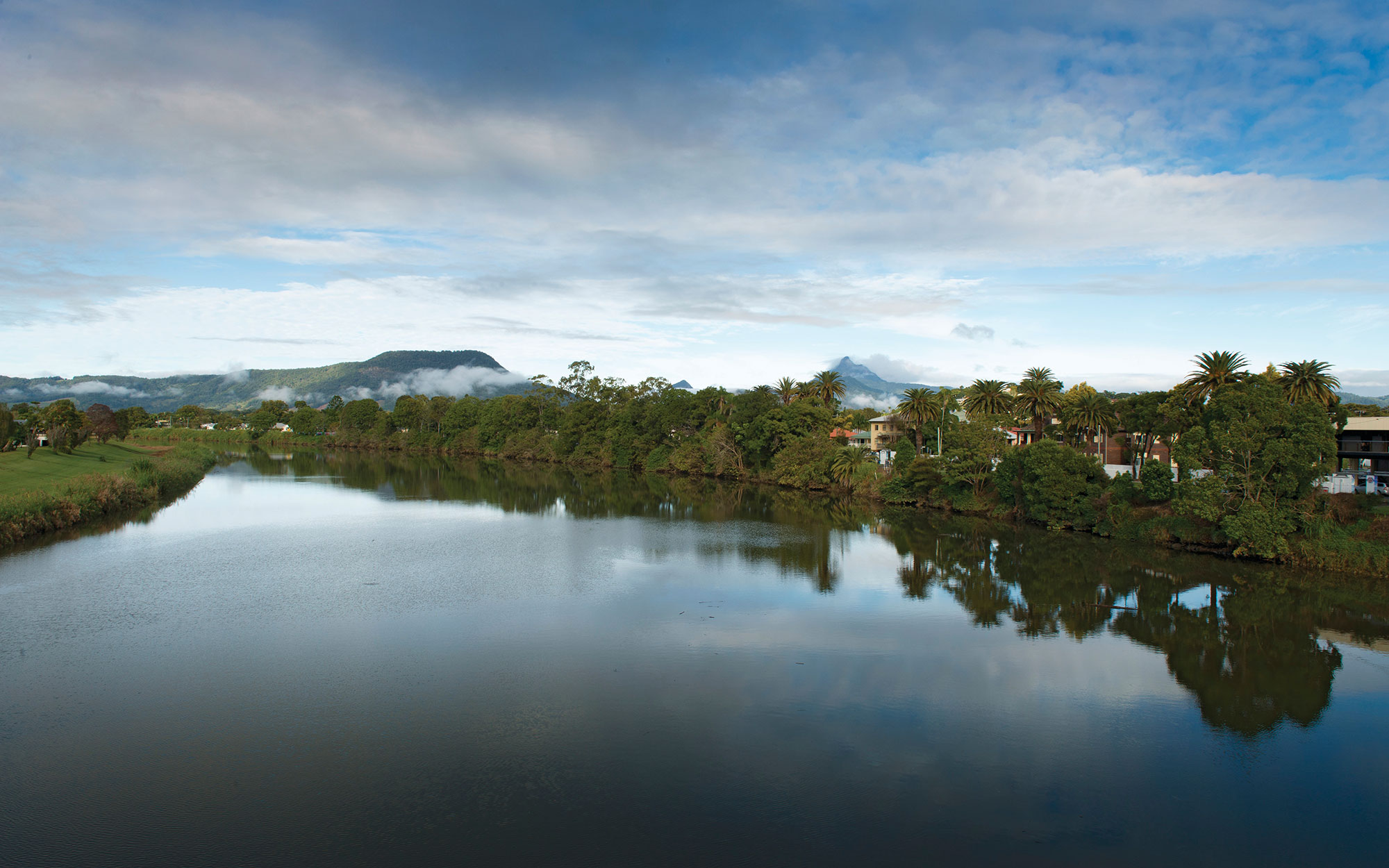
The Tweed is the northern most coastal catchment in NSW. The catchment is bounded by the McPherson Range on the NSW-Queensland border, the Burringbar and Condong Ranges to the south-east, and the Tweed Range to the west.
The highest point of the catchment is Mount Warning, at 1,156 metres. The Tweed River originates on the slopes of the nearby Mount Bushell, and flows north-east to the ocean at Tweed Heads. Much of the catchment has an elevation of less than 300 metres. It has an area of 1,326 square kilometres.
Murwillumbah is in the middle of the catchment, while the major urban area of Tweed Heads surrounds the Tweed estuary. Around half of the catchment population lives in Tweed Heads.
Rivers and tributaries
The Tweed River begins near Mount Burrell in the south-west of the catchment and flows for approximately 80 kilometres to the ocean at Tweed Heads. Its major tributaries are the Oxley River and Rous River which both flow from the McPherson Ranges along the NSW-Queensland border.
The Oxley River enters the Tweed River approximately 7 kilometres upstream of Murwillumbah. The Rous River enters the Tweed about 10 kilometres downstream of Murwillumbah. The ocean tides influence the Tweed River's ecology and flow patterns as far as Bray Park Weir upstream of Murwillumbah.
At the end of the Tweed River, there are 2 small coastal catchments that feed into Cobaki Broadwater and Terranora Broadwater. These shallow estuarine lakes form part of the lower Tweed estuary. Cobaki Broadwater is fed by Piggabeen and Cobaki creeks, while Terranora Broadwater receives water from Bilambil and Duroby creeks.
The catchment also includes a string of small coastal catchments including Cudgen Creek, Cudgera Creek and Mooball Creek.
Mooball Creek drains an area of 109 square kilometres. Its major tributaries, Crabbes Creek and Burringbar Creek, flow east from the Burringbar Ranges through rural valleys. On the coastal plain they join to form Mooball Creek, which enters the sea at Pottsville.
Cudgera Creek has a catchment area of 60 square kilometres. The main tributaries of Cudgera Creek and Christies Creek originate in Mooball National Park and flow east to form a small estuary behind the sand dunes. Cudgera Creek enters the ocean at the small village of Hastings Point.
Cudgen Creek has a catchment area of 66 square kilometres. A major feature of the catchment is Cudgen Lake, a shallow freshwater lagoon which is fed by Reserve Creek and Clothiers Creek. The lake drains into Cudgen Creek which meanders behind sand dunes for 9 kilometres before entering the ocean at Kingscliff.
Water storages
Water supply in the catchment is from the Tweed River when water is available, and from Clarrie Hall Dam in drier months. The dam has a full supply capacity of 15,000 megalitres.
Water users
The largest use of water from the Tweed River is for town water supply for the growing urban area of Tweed Heads. Other water users extract water for irrigation, stock and domestic use.
Horticultural crops include tropical fruits, avocados, macadamias, stone fruit, tomatoes, and other vegetables. Irrigation of the river flats is carried out for dairying, while large areas adjacent to the estuary are used for sugarcane farming.
Most of the national parks and reserves in the Tweed valley are part of the Gondwana Rainforests of Australia World Heritage Area. They contain ancient rainforest communities, plants and animals with evolutionary links to Gondwana, and form part of the largest node of sub-tropical rainforest in Australia.
Two islands in the Tweed estuary are included in the Directory of Important Wetlands in Australia. Stotts Island contains the only substantial remnant of lowland floodplain subtropical rainforest in NSW.
Ukerebagh Island Nature Reserve is one of the largest estuarine wetlands in the Tweed and protects endangered communities of littoral rainforest, mangroves, saltmarsh and seagrasses.
The catchment includes environmentally significant wetlands. The largest of these are swamp forest at Mooball Creek, and extensive wetlands associated with Cudgen Lake and Cudgen Creek, and Cudgen Lake are listed as nationally significant in the Directory of Important Wetlands in Australia.
The rivers of the Tweed catchment have been affected in the past by land clearing, agricultural use, human settlement and recreation. Many streams on the coastal floodplain have been directed into channels, and their flow regimes changed by the installation of flood gates.
The rivers and creeks in the catchment are unregulated. Sharing the catchment's water resources fairly between competing water users such as town water, agriculture and industry can be a challenge, particularly during drought, when water is less and demand high. Water sharing rules have been developed to set long-term rules on how water can be accessed, used and traded within the catchment.